2020 is coming to an end and we are all taking a moment to appreciate on the past twelve months. The HOT-Philippines Mapping Team members are hard at work to provide the best quality of data in our field operations and our mapping and training activities. To help you look back, we prepared a year-end report that summarizes our accomplishment for the year.
HOT-Philippines started the PhilAWARE Project last July 2019 which is a local installation of DisasterAWARE, a disaster risk reduction and integrated early warning and decision support system that also incorporates many data layers form OpenStreetMap.
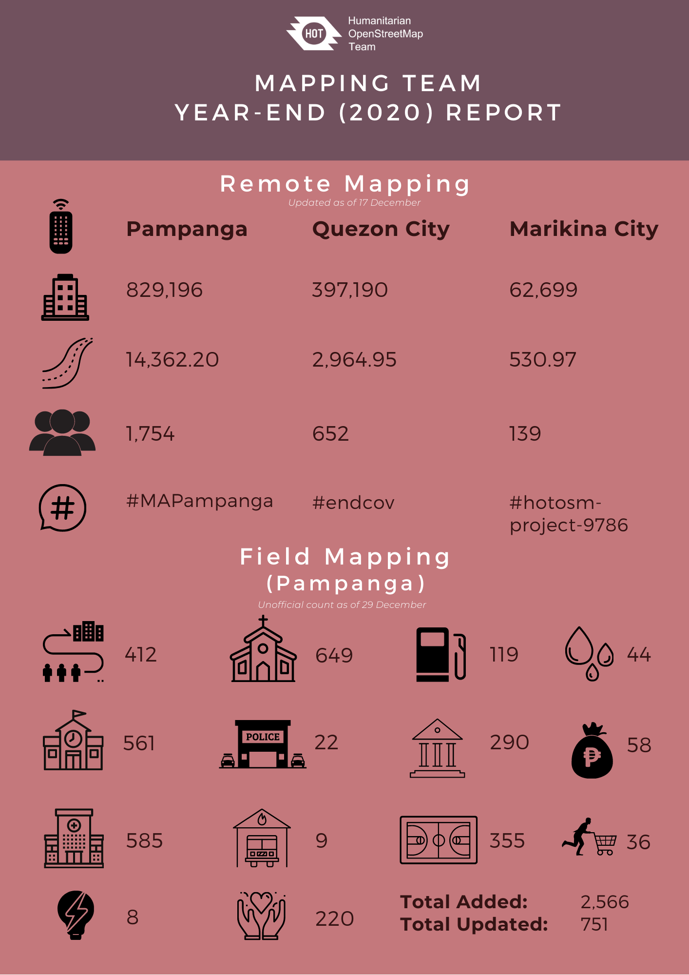
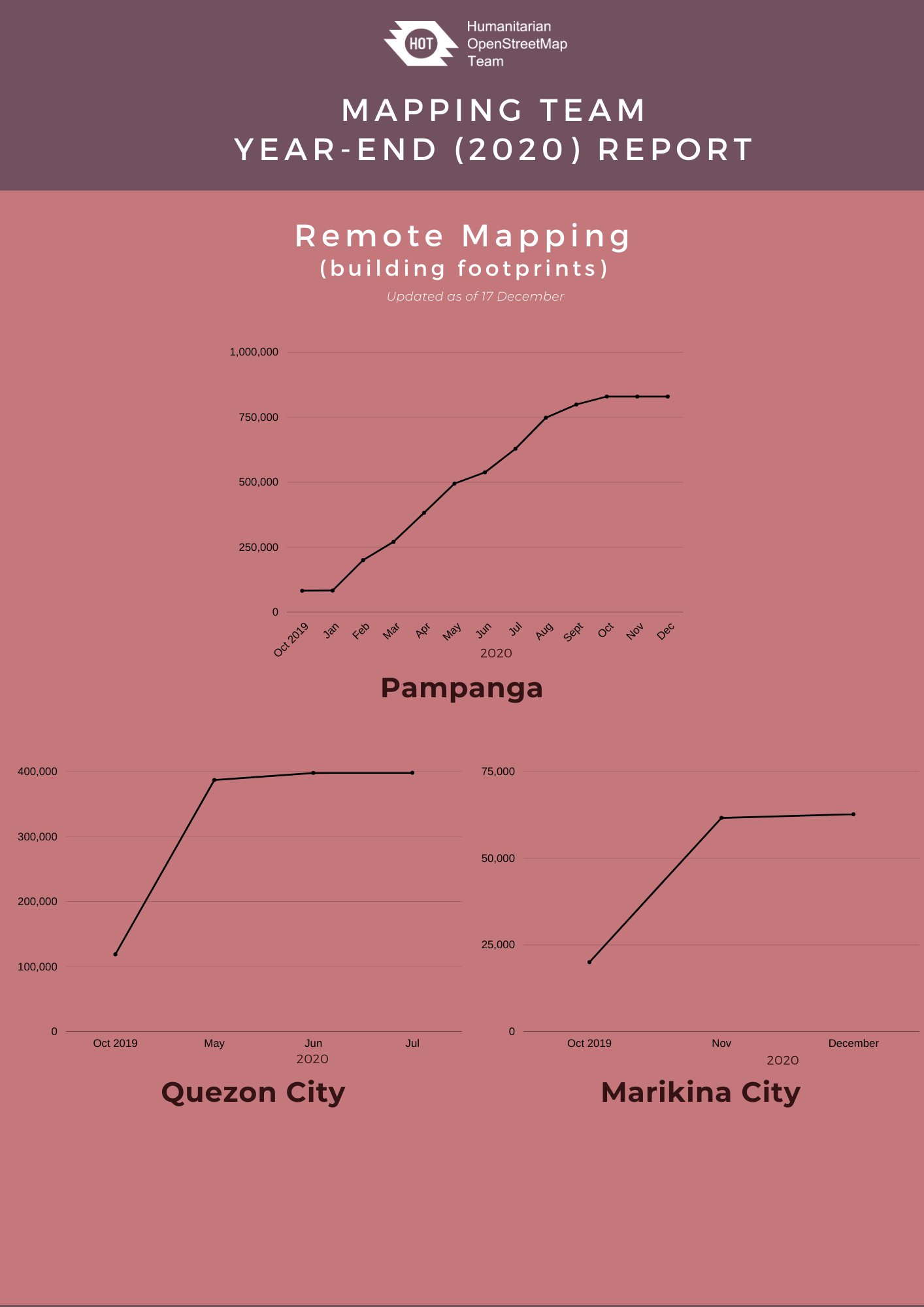
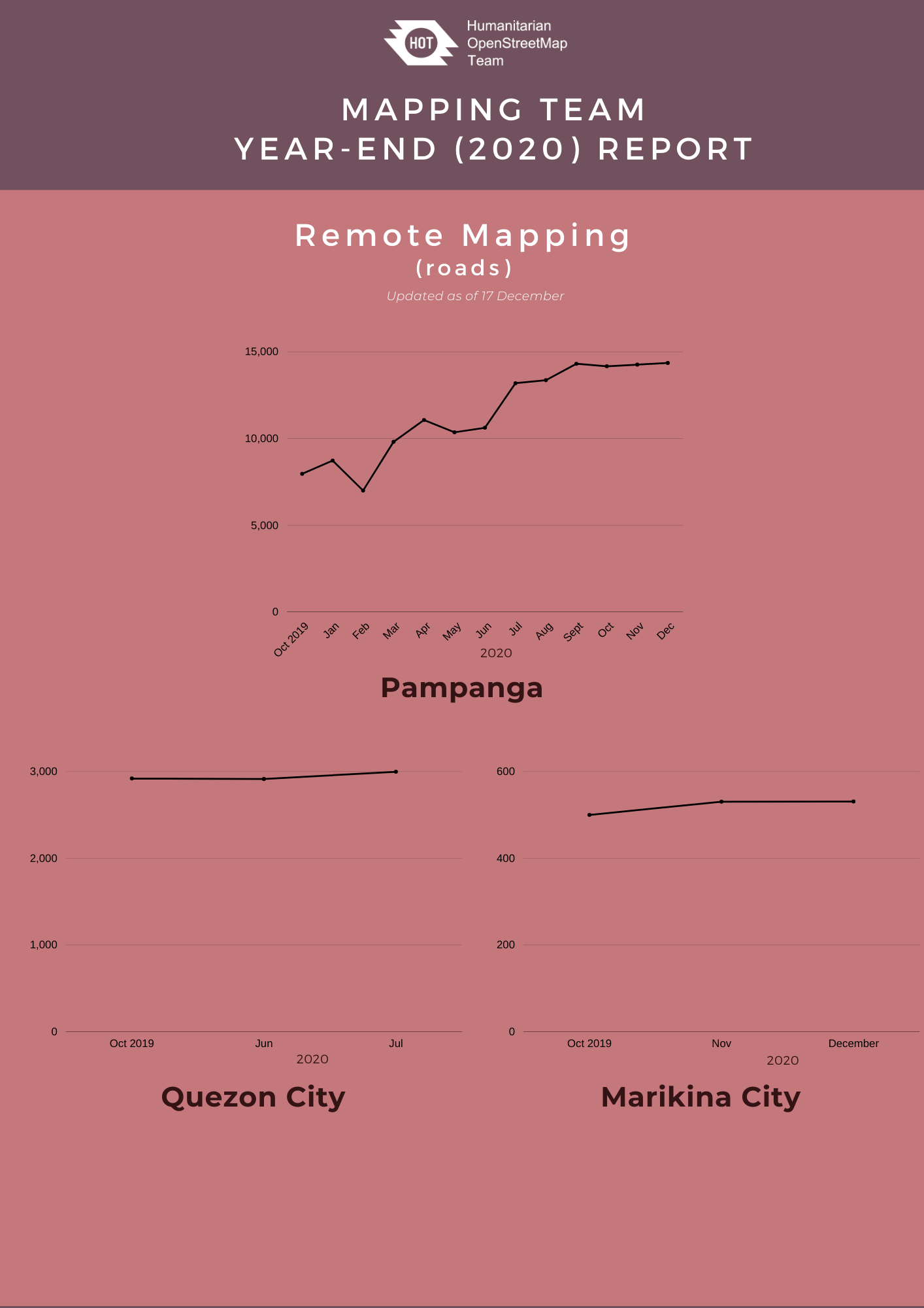
Part of the activities of the project included remote mapping in Pampanga, Quezon City, and Marikina City. Remote mapping and validation activities for Pampanga and Quezon City were completed with the help of volunteers, organizations, partners, and other stakeholders while Marikina City is still in progress.
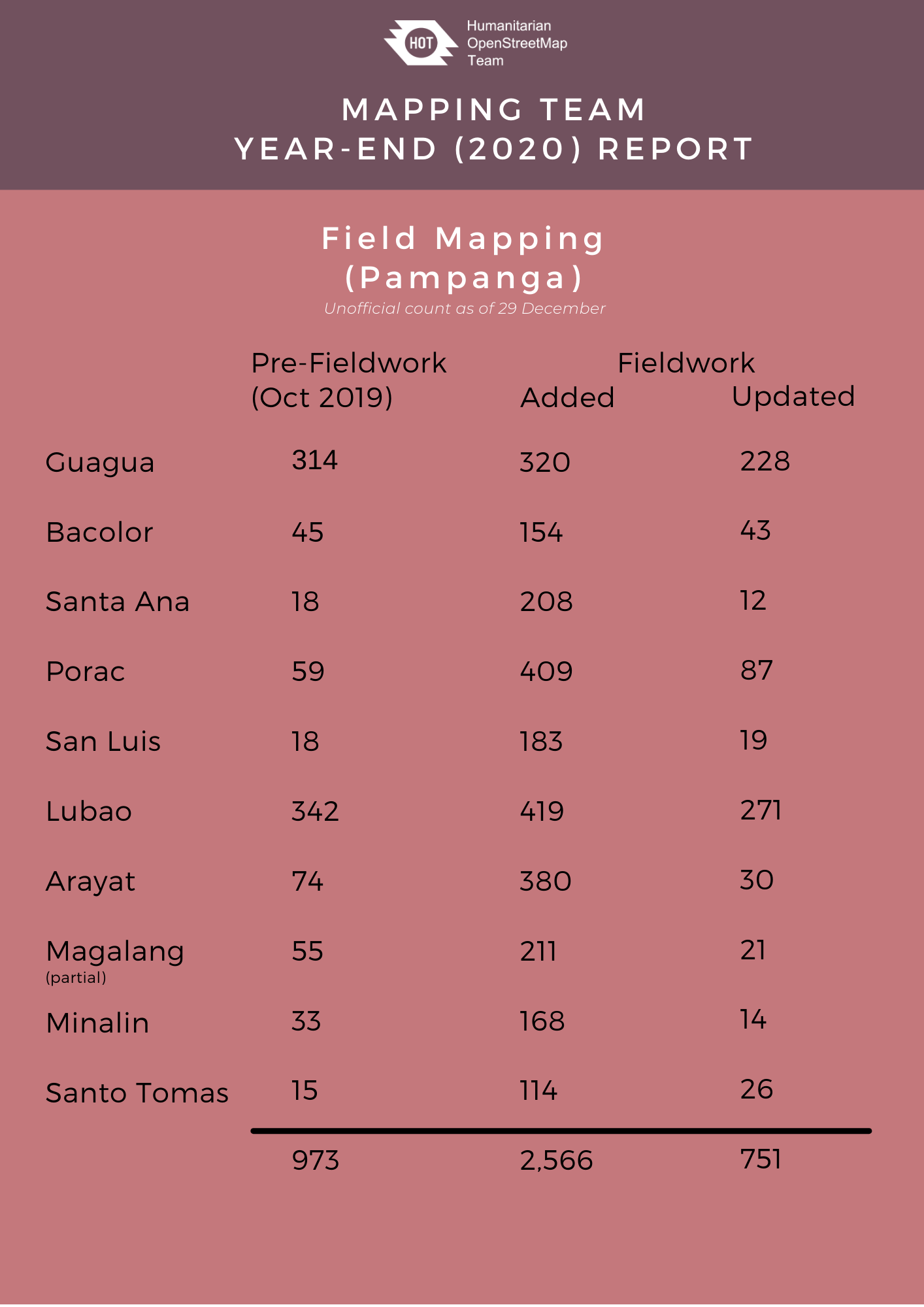
Aside from the remote mapping activities, we also began collecting the critical lifeline infrastructure data from the ground in the municipalities in Pampanga. Our field operations was made possible through the support of the local government offices and volunteers in Pampanga despite the restrictions of COVID-19.
Alongside the PhilAWARE Project, we supported OSM Philippines' OSMaPaaralan Project which is an initiative to collaboratively map public schools (paaralan) in the Philippines using OpenStreetMap. Our team is validating location of schools in Pampanga and updating information related to emergencies. If you want to contribute and learn more, head over to the MapRoulette task and help OSM-PH complete the project!
The pandemic has a large impact on our remote and field mapping operations. Our team has encountered a lot of challenges such as postponing and slowing down of field mapping activities because of sudden lockdowns and surge of active COVID cases, resigning staff due to COVID-19 safety threat, as well as self-isolation caused by experiencing COVID-19-like symptoms but we were still able to pull them through. [We also made a documentary on how COVID-19 remapped the reality and presented it during the 2nd day of Pista Ng Mapa. Video available online soon.]
While being affected by the pandemic, we are part of the UP Resilience Institute's initiative to end COVID-19 (#endcov). UP Resilience Institute collaborated with HOT-PH in mapping and validating the building footprints of Quezon City. The data were used by UPRI to develop a data-driven analysis and recommendation to the local government unit of Quezon City for the city's pandemic response. [We created a poster about this initiative and participated at the State of the Map 2020's Poster Exhibit].
We would like to thank everyone for the continued contribution and support in our project. We hope to see you again next year!